Here’s a key point I made in today’s pop-up webcast:
Think of Tornado Alley as a syndrome, not a place. And it isn’t what, and where, it used to be.
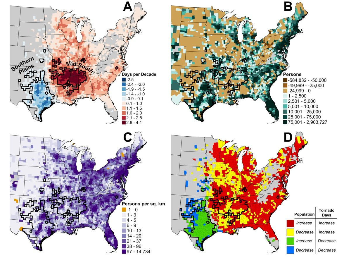
In 2018, longtime tornado researchers Victor Gensini of Northern Illinois University and Harold Brooks of NOAA’s National Severe Storms Laboratory in Norman, Okla., completed widely-covered research showing a substantial shift in the particular meteorological conditions that are most apt to generate tornadoes (and a shift in tornado reports).
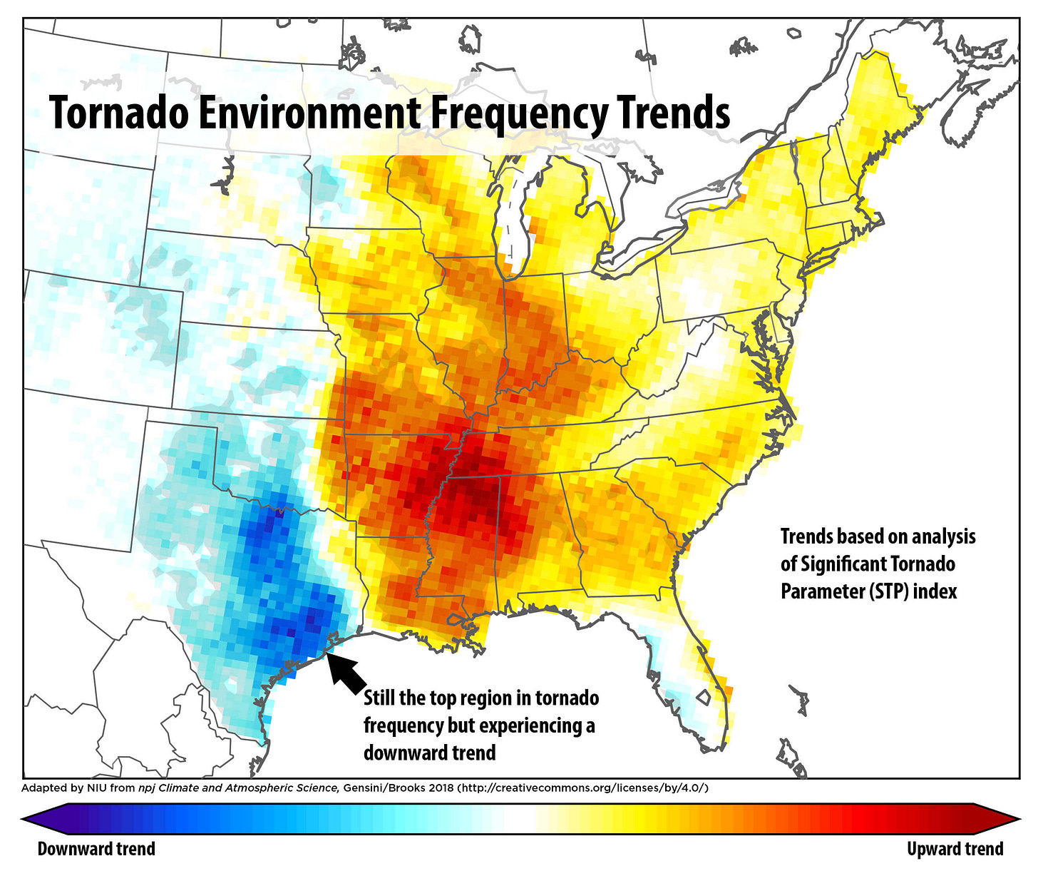
Media coverage, then and since, has tended to zoom in on the hot question: what role is played by human-driven climate change? The science around tornadoes in a human-heated climate, however, remains infused with uncertainty.
But that murk can obscure what a new paper makes soberingly clear: that expanding populations and sources of storm vulnerability - particularly flimsy housing - are greatly increasing the risk of big losses even in areas, like Texas, with a downward trend in tornado-generating weather conditions.
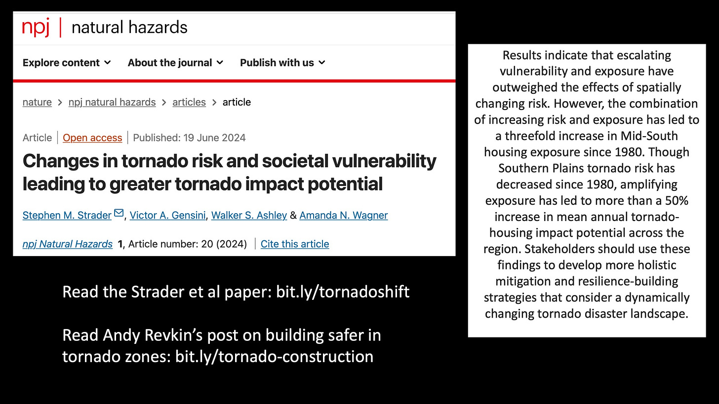
The new paper, published in the Nature journal Natural Hazards, is “Changes in tornado risk and societal vulnerability leading to greater tornado impact potential.” The authors are Stephen M. Strader of Villanova University, Victor Gensini, Walker S. Ashley and graduate student Amanda N. Wagner of Villanova.
Here’s the core point from the abstract (the highlights are mine):
Results indicate that escalating vulnerability and exposure have outweighed the effects of spatially changing risk. However, the combination of increasing risk and exposure has led to a threefold increase in Mid-South housing exposure since 1980. Though Southern Plains tornado risk has decreased since 1980, amplifying exposure has led to more than a 50-percent increase in mean annual tornado-housing impact potential across the region.
I reached out to Strader for a pop-up Sustain What chat. He’s been an all-too-frequent presence in my webcasts on the “expanding bull’s eye” that far too many communities are creating in meteorological danger zones. He and Walker Ashley have done invaluable work building this method for mapping hazards, exposure and - incresaingly factoring in the vulnerability of the people or property in harm’s way, as in this paper.
I hope you’ll share our conversation here with anyone living in the map areas (lower reight) shown in red, yellow or green, or do the same with the webcast video on X/Twitter, Facebook, YouTube or LinkedIn.
Here are the key takeaways Strader offered in a thread on X today (which we explore in more depth and detail in the webcast):
Despite tornado environments becoming less frequent across the Southern Plains, growing exposure [more people and more stuff] has more than made up for this dearth. There has still been a 50-percent increase in Southern Plains expected tornado-society impacts due to rapidly growing exposure.
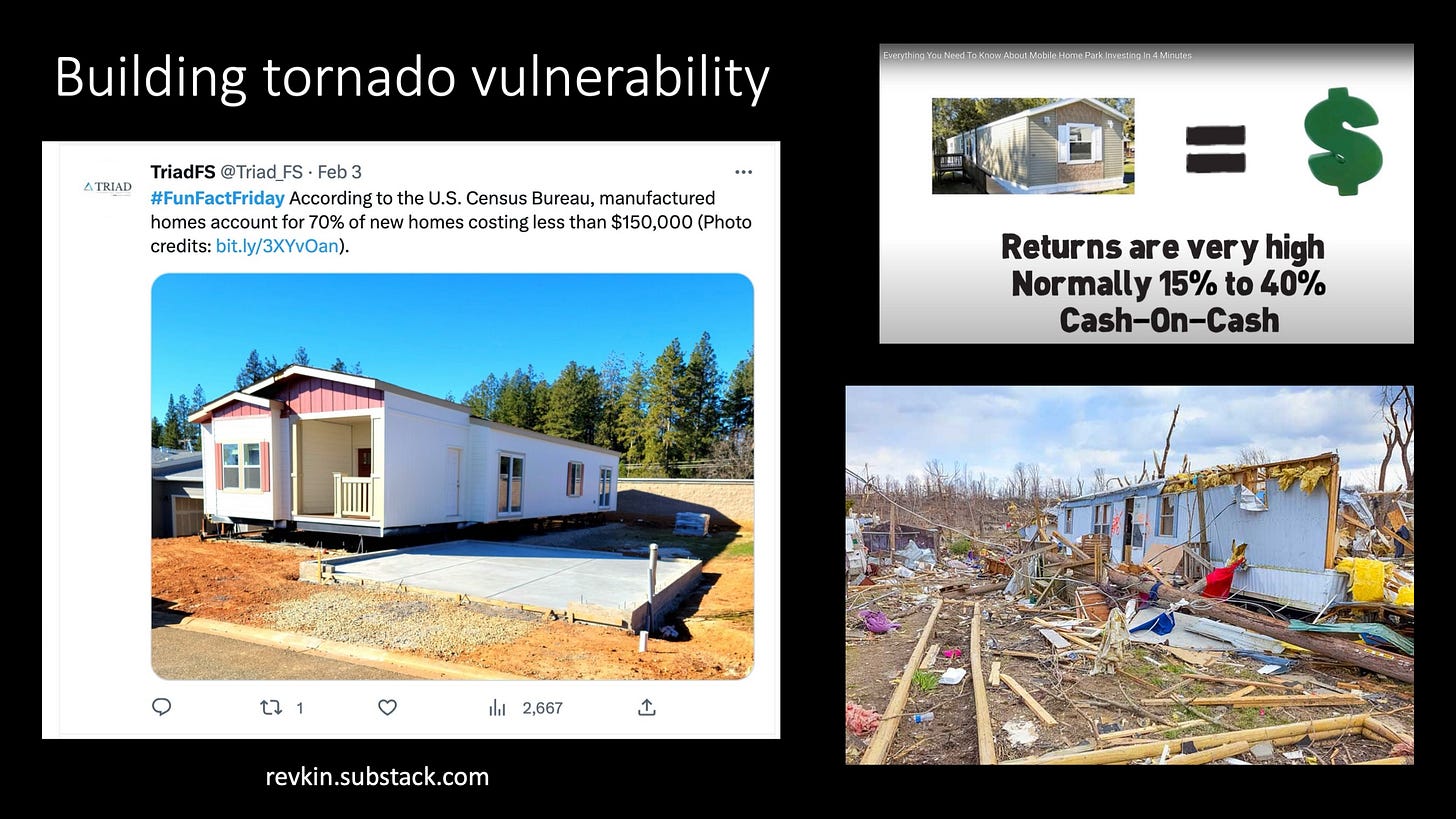
Societal vulnerability has also played a substantial role in the severity of these impacts. Most notably growing manufactured home prevalence [and] those aged 65+, non-white populations, and single-female head of households have all increased in the Southern Plains and Mid-South.
To reiterate, exposure changes are by far driving impacts, not spatial changes in environments. Unfortunately, changes in both mean bad news for the most tornado-fatality-prone region, the Mid-South.
In our discussion, we focused on a prime fixation for Strader (and me) - the boom in manufactured homes across the South.
Here’s an earlier Sustain What discussion on this point:
Seeking Safer Shelter as Death Counts Rise in America's Shifting Tornado Danger Zones
INSERT - Watch my Sustain What webcast with some of America's top experts on how to build safer in tornado danger zones. I was joined by Daphne LaDue of the University of Oklahoma, Ian Livingston of the Washington Post’s Capital Weather Gang blog, the “expanding bull’s eye effect” researchers


