


Amid the still-unfolding tragedy following the Nepal rock and ice collapse and tsunami-like mountain flood, there are hints of a safer future.
That was the core idea emerging from a pop-up conversation I had Friday with Basanta Raj Adhikari, the director of the Center for Disaster Studies at Tribhuvan University in Nepal. He had just returned to Kathmandu after an overflight and on-the-ground inspection of the demolished path of the August 26 water and debris flood. He laid out the gargantuan scale of the destruction and losses and we explored next steps.
We dug in on the physical processes behind the event, the challenges trying to monitor high-altitude hazards, and the need for more international scientific cooperation.
We were joined partway through by Manoochehr Shirzaei, a geophysicist at Virginia Tech whose specialty is studying ground subsidence and motion using satellites and other sources of data. On X, he’d posted a fascinating rapid analysis of seven months of Sentinel-1 data (right up until one week before the rockslide) appearing to show the slow downslope movement of the bedrock in the region had been accelerating.
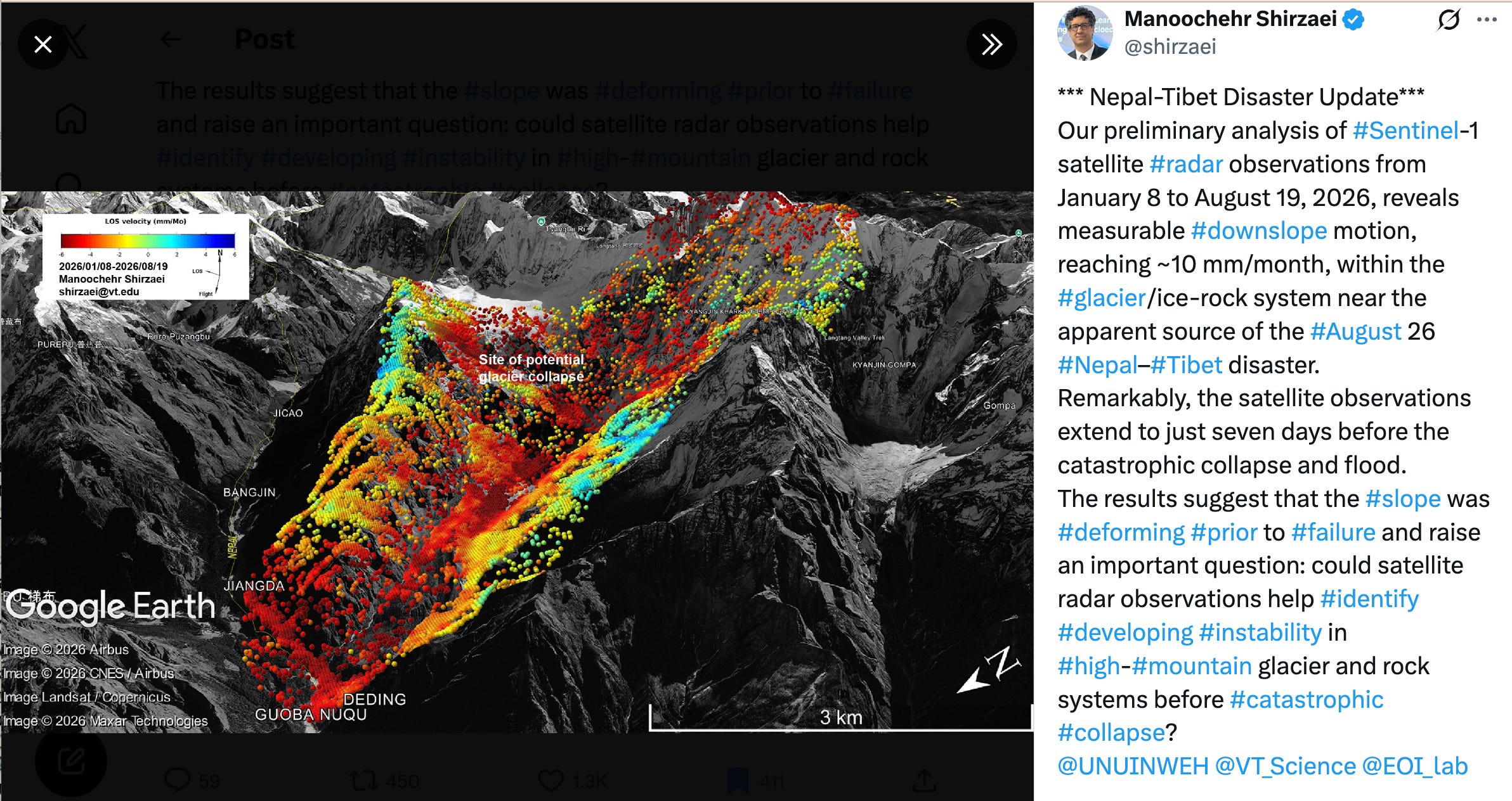
In his tweet, Shirzaei said, “The results suggest that the slope was deforming prior to failure and raise an important question: could satellite radar observations help identify developing instability in high-mountain glacier and rock systems before catastrophic collapse?
It’s far too soon to have a clear picture of the cascading and interlaced sequence of events high on Lantang Lirung mountain and a team including Adhikari is assembling to assess the causes and consequences.
But if it turns out that satellite tracking of subtle deformations of mountainous landscapes might reveal advance signs of such an event, this could lead to better warnings and fewer deaths, both of my guests said. (It is clear this is an area where artificial intelligence could help identify danger hot spots.)
But this will only happen with a lot more integration of data sets and expertise in disparate fields, combined with far more education and planning in the crowding communities across the Himalayas.
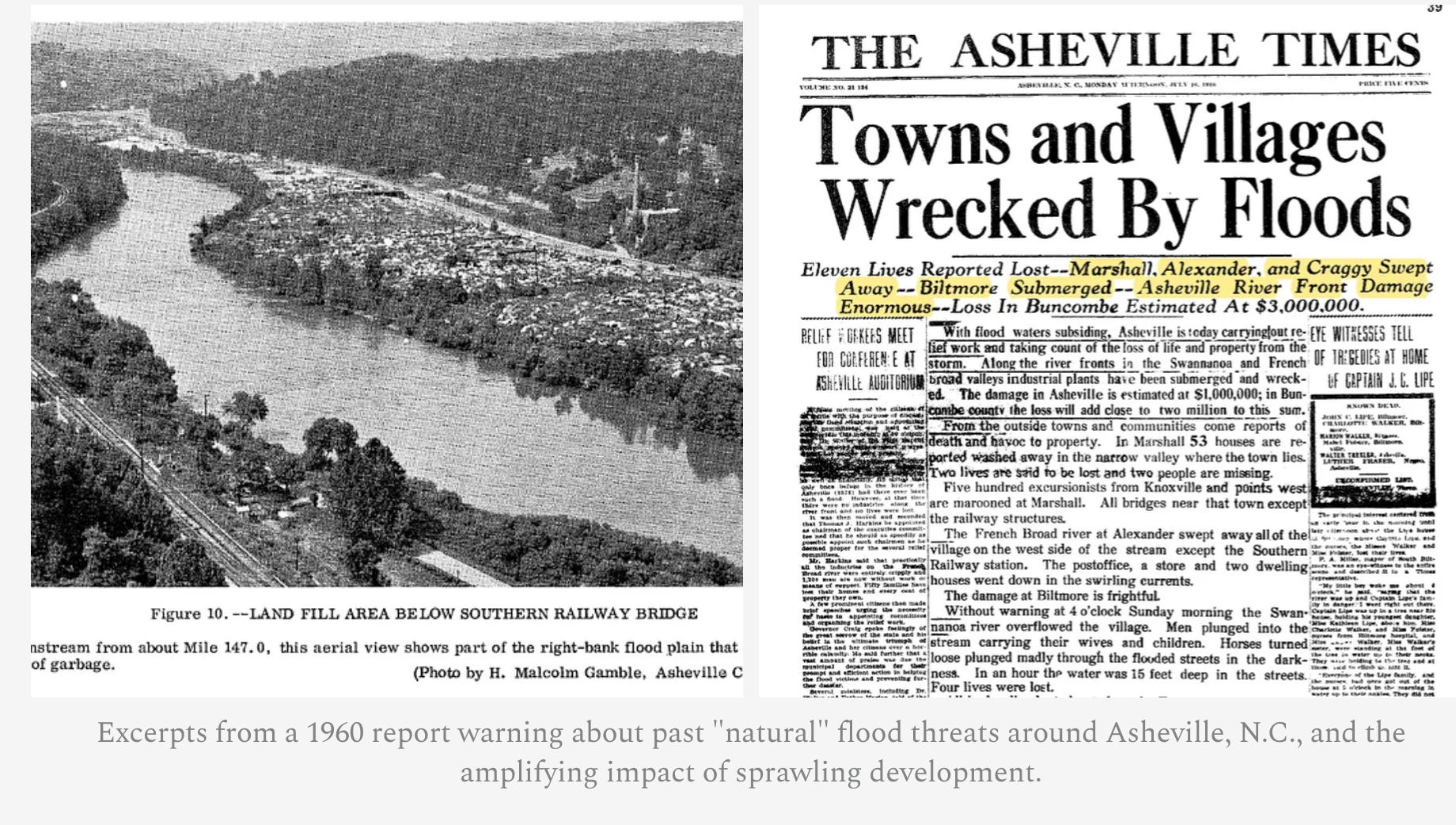
I mentioned how the deadly extreme flooding in western North Carolina from the remains of Hurricane Helene was essentially a small-scale version of the August 26th Nepal disaster.

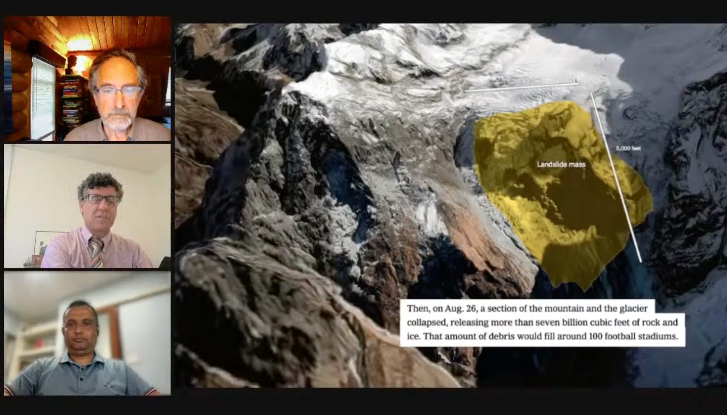
We walked through a fantastic New York Times visual report showing what is known at the moment about the sequence of events.
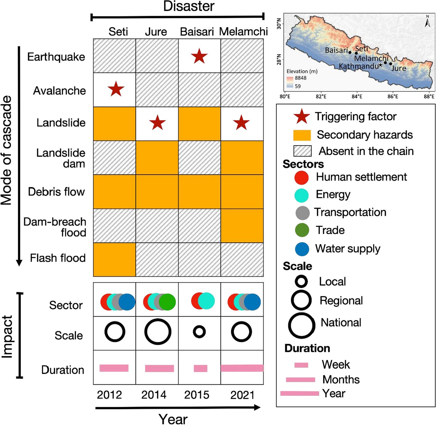
We discussed the findings in a paper co-authored by Adhikari and many others titled “Increasing risk of cascading hazards in the central Himalayas.” Here’s a graphic that’s worth sitting with:
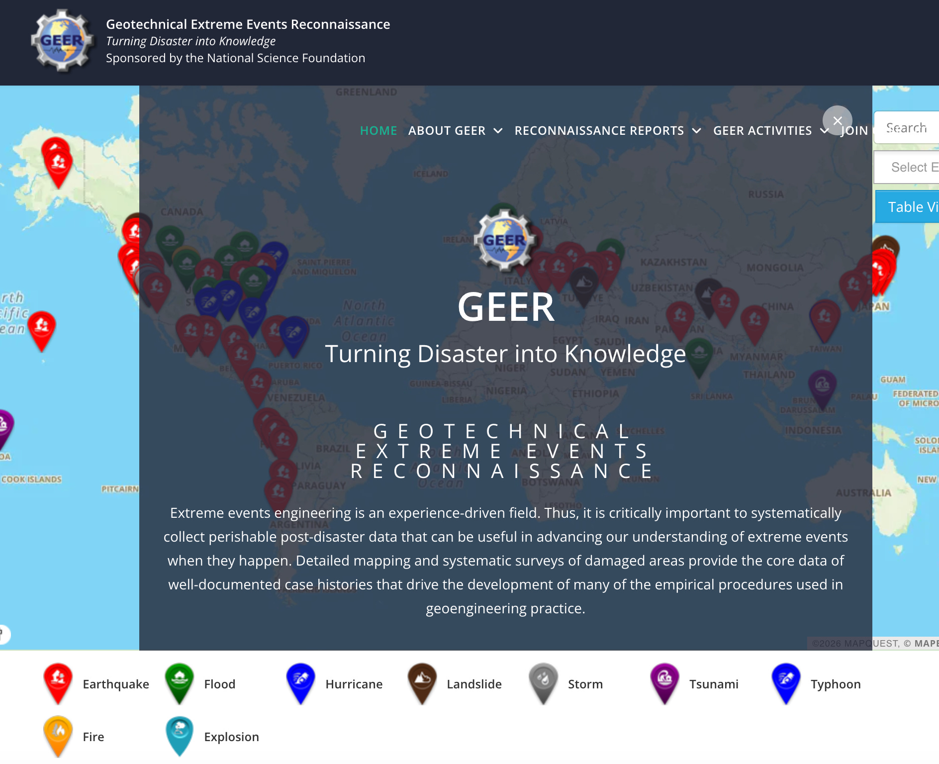
I learned about an important, and mostly voluntary, international Geotechnical Extreme Event Recconaissance Association, aiming to “systematically collect perishable post-disaster data that can be useful in advancing our understanding of extreme events when they happen.”
There’s lots more to learn of course, and the best way is to listen above or on the podcast outlets listed higher in this post.
Please share what you learn!
Thank you to everyone who tuned into my live video! Join me for my next live video in the app.

Also see my earlier post about Adhikari’s work:
How Himalayan Warming, Geology and Vulnerability are Creating a Disaster Hot Zone

I’ll be doing more on the dangerous Himalayan mix of a warming climate, unstable geology and glaciers and massive exposure and vulnerability of human communities. Here’s yesterday’s pop-up conversation:


